Woburn Hydrogeology Data
Well Logs
|
Woburn Hydrogeology Data |
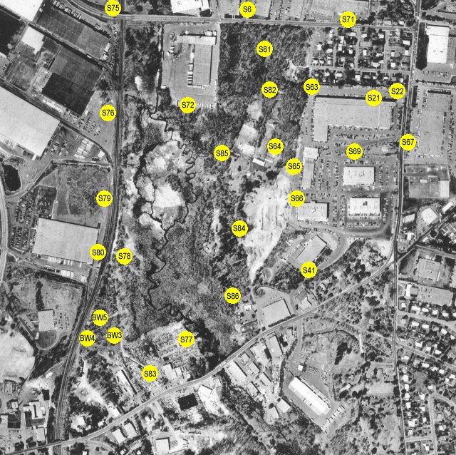
Each of the yellow dots below represents the location of a well log. Click on the dot to view the well log in pdf format. The well logs are from the appendix of the NUS Report. Not all of the well logs listed in the NUS Report were used on this map. Aerial photo provided courtesy of Scott Bair.